Showing posts with label part 4. Show all posts

Thursday, November 23, 2017

Mile-High Walk Part 4 - Den on the Frontier

It was a hair before 7:00 AM, I’d driven 125 miles and flown a thousand more.  The heck just happened?  I was asleep in my bed eight hours ago!

Technology is pretty cool.

As was the case with both MDW and ORD in 2015, I planned for time to do a complete airport walk; this time, I planned carefully with the hope that we’d land, I’d deplane with time to spare to get to a great vantage point and catch the sun rise over the plains to the east.


Agh, short-armed it.

Well, we’ve got a schedule to keep.  Let’s get right to it.


Denver’s airport, or “DEN” in airport lingo, is comprised of three concourses and a main terminal.  Each of the three concourses and the terminal are all connected by an underground train, which is good both because DEN is big and because the train is the only way to get to the other two concourses from the first.

And that first concourse is where we find ourselves, right at one end, conveniently.  Concourse B and C have pretty much one main airline that uses them.  Concourse A, on the other hand, holds everybody else.

Each airline has its own little section in Concourse A, making connections fairly easy along the length of the concourse.  Delta, American, and all internationally based carriers call this concourse home.  The southern side of the concourse serves as Frontier’s base, making connections theoretically painless.  They serve 53 non-stop destinations from DEN over the course of a given year, if you can believe it, all from eight little gates.  Not bad for a ULCC.


Marching down the concourse, it’s easy to see where each carrier has staked out their claim, both from the gates, lounges, and the branding throughout the concourse.  The east end has five gates dedicated to American Airlines service to their major U.S. hubs, representing the smallest share of gates assigned to a mainline U.S. airline.  A staircase takes you down to a tiny addendum that services local airlines Great Lakes Airlines and PenAir, as well as ULCC Spirit Airlines. 


Frontier and other ULCCs have been the butt of airline jokes for a while, but Spirit Airlines has to have been the butt-iest.  Frontier’s my first time on a ULCC, but I’m still interested to give Spirit a try to see if it’s as awful as people say.  I doubt it is, but that’s just one perspective.  Spirit’s branding and color scheme is bright, flashy, and informal, not at all like the classic designs of legacy carriers that ferry the majority of travelers across the U.S. 

Great Lakes Airlines is the only commercial air link between Cheyenne, and several other local airports, and the outside world.  They mostly fly Beechcraft 1900 9-seaters and a handful of other, larger turboprop planes.  Having done this kind of turboprop fly-in once to get to St. Louis aboard Cape Air, it’s an experience I’d highly recommend.  There’s something neat about leaving the sticks in a little plane, entering the big city and seeing the world spread out below, and before you. 


Each concourse’s train station meets at a centralized node at the heart of the concourse.  These nodes really give the airport that open feel I always like in large hubs.  Tall ceilings, lots of windows, abstract architecture.  For now, we’ll keep moving to the other half.


In 2015, my wife and I landed here to begin our anniversary trip.  Six gates on the west side of Concourse A handle Delta, which send flights to their main hubs around the country, including a little hop to LAX, an airport with the unique distinction of being designated by all three major U.S. carriers as a hub.

Today, this flight’s going to Seattle, one of Delta’s newer hubs.  I’ve never been to Washington, but I’ve heard SEA is a nice airport.  Many aviation geeks head up to SEA both for the airport itself as well as the nearby Boeing factory and Payne Field, where brand-new, liveried jets run their test flights before delivery to their customers around the world.

Before we move on to the next concourse, I think it bears mentioning DEN’s innate optimism.


The signage in each concourse’s east wing points to X## to X99, indicating that there are 99 gates.  Well, this isn’t true for any of them, but DEN was built with expansion in mind.  DEN is, itself, an expansion.  Until the mid-90s, Denver’s air traffic was handled by Stapleton Airport.  When Denver’s needs grew too large, plans to build an airport in the suburbs of Denver emerged.  They bought a lot of land and built wide.  Stapleton was closed, it’s IATA designation of “DEN” was reassigned to the new airport, and developments sprung up on the old site of the airport.

Today, all three concourses at DEN can be spread out west and east without impacting the airfield, meaning that one day, there might actually be 99 gates.  As a forward-looking airport, they went ahead and put up the signs to indicate the future. 

Replacing the sign each time there was an extension couldn’t be terribly expensive, so I like that they advertise inevitable expansion to be plainly seen by transiting passengers.  The same is true coming the other direction, too.  There is no gate A1.  In fact, A26, across the hall from the gate in the last picture, is the westernmost gate in the concourse.  After seeing so many airports seemingly surprised by their popularity and scratching their heads figuring out how to meet it, it’s nice to know one airport is systematically prepared for growth.

Let’s zip down the line to Concourse B, Denver’s biggest and busiest.  To do that, let’s head down a pair of escalators at A’s central node, hop on one of the trains that swing by about every two minutes, and ride!


While Concourse A has a long way to go to hit 99 gates, Concourse B is pretty close.  Longer on either side than either A or C, B has about 70 gates and has been expanded twice.  Unlike Concourse A, Concourse B is all one airline: United Airlines.  The now-defunct Continental Airlines was merged with United several years ago, and since then, every other tenant of the concourse moved elsewhere, usually as part of a merger themselves.  Now, United holds all of the gates, making connections easier.

From the central node, we’ll head west to the older part of the concourse first. 


This part of the concourse hosts United’s larger flights, especially on the southern (left) side.  Long-haul flights to United’s far-flung destinations like Tokyo, Hawaii, and, occasionally, Costa Rica leave from these larger gates.  The other mainline United flights leave from here, either between other hubs or larger, regional destinations.  Many times, though, it’s fairly empty here.


This isn’t a bad thing; I love a big, empty, quiet space while I travel, too.  The western end of the concourse features a lovely view of the Rockies.  In fact, most views from DEN feature either the flat expanse of the High Plains and/or a view of the Front Range.  When you’re here, you can’t forget where you are.


I listen to lyricless music while I walk through airports, usually what would be defined as electronic, techno, or ambient music.  I carefully craft playlists to fit certain moods of travel, whether it’s high-paced, high-rhythm music while I’m charging across a terminal to make a tight connection, or slow-paced, mood music that I feel reflects the joy and excitement of travel.  When I’m in these quieter parts of the airport, I can actually hear what’s coming out of my earbuds, and it puts me at ease.  Sometimes, even with a structured schedule, I’ll sit down and take a break, listening to the smooth, ambient music I’ve selected, feeling my heartbeat, the weight of my bag on my shoulder, the dryness in my mouth from the low humidity of an airplane cabin, and imagine all the unseen places of the world that are just a flight away.

A quick glance at my phone tells me I need to keep moving.  I pull myself up from my solitary seat, reposition my camera bag, and head east.


Beth and I flew out of B46 in 2015 on our way home.  That particular flight went to Chicago, where I’d been months before on my Chicago walk.  Today, they’re off to San Francisco, a city that’s high on my list for a walk.  One day soon.

Concourse B’s easternmost sections are somewhat temporary additions to accommodate United Express, their regional affiliate, and the formidable amounts of traffic they provide to Denver. 


The first extension, which peels off the northern edge of the concourse’s eastern terminus, is a narrow corridor that, for lack of a better description, is like walking through a shipping container.  You board through the corridor, then file down to the actual gate, without a jetway, and walk planeside to board. 

Modern airline passengers in the U.S. don’t actually board planeside much anymore.  The first time I did it was back in Comair’s heyday in the 90s; our family was connecting in Cincinnati, so we flew from Louisville to Cincinnati, a two-hour drive at most, in a flight time that was filed as seventeen minutes.  By far the shortest flight I’ve ever been on, that little connector will always be memorable. 

You can’t get back there unless you’re actually flying, but even if I could, I’m not sure I’d have enough elbow room to hold up a camera.  This would be for low-volume routes like, you know, to Gillette, WY; Medford, OR; or Minot, ND.

The southern extension, on the other hand, is pretty unique.


At the end of the Concourse B, you hang a right, go down a corridor, and head down an escalator to a tarmac-level extension with small, regional jets on either side.  The jetways convey passengers at ground level, but it also provides a unique view of the airfield in general, including some neat parked jets.


This B757 heads between Denver and Reykjavik, Iceland daily, if you can believe it, departing here in the late afternoon.  Iceland has grown over the last few years as an exciting, accessible destination for young, budget-friendly travelers.  Put another way, my generation.  I’ve been hoping to get to Iceland for a while, but it’s on the back burner behind some other destinations.  Still, won’t see this livery in Louisville.

To be honest, the extension reminded me of STL’s main terminal; it was plain, utilitarian, and well-laid out, if not terribly interesting. 

I stopped for a second, charging my flashing camera battery and enjoying another energy bar.  I was a tiny bit ahead of schedule, so I could stand to pause and give myself and my camera some juice.  Concourse C wouldn’t take long.

After a few minutes, I packed up, emptied my camera bag of trash, and then made my way to the last concourse.

Concourse C is another single-tenant concourse, this time run by Southwest Airlines.  This has become more common around the country, as Southwest’s business model is different from legacy carriers, it makes sense to have a specific space to cater to their unique system.


Fittingly, this concourse has a plane suspended above it.  Unfittingly, it has bizarre architecture around its train station, one that I’ve seen several times before and still am unable to totally understand.


This concourse is open and quiet as well, but closer to the gates, things pick up.


In my opinion, Southwest-centered airports or concourses have a specific feel to them that’s distinct from normal airports.  BWI, MDW, and even SDF’s Southwest concourse have a unique aura.  They always seem to have good food options, a unique design, and little touches to distinguish them from other carriers.  I’m not sure how much say Southwest has on that, but it feels like there’s some, at least.  It could also be the clientele, who are usually families, younger travelers, and tourists that grant Southwest-oriented areas a bit of flair. 

Concourse C is abridged compared to the others, with only one section on its eastern side and two to the west.  A quick walkthrough is enough to check it off the list before boarding the people mover back to Concourse A.  While the train goes all the way back to the landside terminal and out into the world, I wanted to disembark in Concourse A for the walk across the pedestrian bridge.

After hopping off at concourse A, I went up three escalators to the upper mezzanine, following the signs to the bridge.


To the east and west, you can see Frontier’s staked claim.  Unlike seeing a row of Southwest planes, Frontier’s Airbuses each sport unique livery. 


No sign of Courtney the Cougar; N702FR must have left for greener pastures while I was walking.

This pedestrian bridge, which connects Concourse A to the main terminal, is somewhat unique, allowing planes to pass safely underneath it while onlookers watch.  It provides wonderful views of the Rockies, as most western-facing windows in the airport do. 

That about wraps it up airside.  After walking past the large “no re-entry” signs on the south side of the bridge, we get to perhaps the most visually recognizable building in all of Colorado: the Jeppesen Terminal.


The landside terminal is named for Elrey Jeppesen, famous Colorado-born aviation and navigation pioneer.  The roof’s design is designed to emulate the Rocky Mountains as well as the traditional homes of Native Americans from the High Plains: tipis.  The cavernous terminal has tons of food options and a museum to Jeppesen, among other things, but we’ve got a train to catch.  Moreover, there’s a couple more things to see outside before we head out.


Denver has recently built an all-new transportation complex outside the airport, complete with a fancy new Westin hotel.  The hotel’s modern architecture blends with the seemingly avant-garde stylings of the airport itself. 


Denver’s airport is huge, and someone’s gotta keep all those windows clean.  That guy right there.  Just that guy.  Well, no, probably not just him.

There’s an escalator that takes you down to the transit center, where the brand-new train station awaits.


When Beth and I were here in October 2015, this train station didn’t exist.  Now, less than a year later, you can take a train, without transfers, directly from the airport to downtown Denver.  Not a moment too soon!

The cost of the ticket is steep by city transit standards, $9.00, but it still beats a bus or heaven forbid a cab.  DEN is enormous, and for it to be so big, it has to be a long way from the city.  As the crow flies, I’m standing about 18 miles from Downtown, and on the flat plains of Colorado, you can really feel that distance.

I’ve got my ticket in hand, and the train that arrives here only goes one way, so it’s just a matter of waiting for the next one which, as it turns out, was pulling up now.

I took a seat on the now empty train and pulled out my journal, taking all the notes I’d need to make this post.  Forty minutes later, I’d be at historic Union Station and ready to commence my walk for real.  I love airports and all, but I travel for more than just travel’s sake.  Let’s explore Denver!

Until then, keep going!

Wednesday, April 22, 2015

Walking the Windy City - Part 4

This is the fourth installment of this journey; here are the links for the first, second, and third installments.

Part 4

The train tracks roared beneath me as a train passed, and soon I was on the other side of the old iron bridge to the lake front, where I’d travel along the trail for a while.  I crossed Lake Shore Drive, a non-interstate highway that follows, you guessed it, the lake shore both south and north of the city. 


The end of the bridge had a stone and iron switchback staircase.  As I hopped down each step, I was reminded of going to visit my wife when she was in undergrad; the parking garage’s staircase was built the same way.  It was one of those that go down the center of the structure, curl around to the outside, then back to the center with each level.  It’s basically two mirrored staircase slapped together.

The Lakefront Trail is the pedestrian path that parallels the highway, and it meanders through a large greenspace along the whole length of the whole city.  The park that surrounds it is unique.  In most cases, lakefront properties would comprise the most attractive real estate in the region, but here, grass is the biggest tenant. 


If I need to remind you, it was cold.  At this point of the walk, even with the sun out and beaming, you’d be hard pressed to find anywhere in the city that was even close to breaking the freezing point.  Thus, the lakeshore was particularly chilly, as there weren’t any obstacles to hinder the wind.  To add to my discomfort, my stomach rumbled, announcing it had digested my first protein bar.  I consumed a peanut-butter-flavored one, and it wasn’t bad.


I have literally no idea what this is supposed to be; lifeguard stand? Visibility beacon? Abandoned gibbet?  After getting sprayed overnight with lake water, the freezing temperatures have turned this metal pole, and everything around it, into a frictionless popsicle. 

I pretty much had the park to myself, but there were a few runners.


Chicagoans are made of foam insulation and whale blubber, apparently, because this guy is running in little bitty shorts.  I’ve heard some runners make the argument that you run in loose-fitting clothing no matter what the temperature is, but I prefer to be warm and chafed then freezing and breezy.  No thank you; still, good on this guy.  Even in warm clothes, I had several moments I thought twice about lengthening my total distance, so I can’t imagine his dedication.

After the runner passed, I decided to get closer to the icicle pier and I found something pretty bizarre.


As I approached the beach, which was much like an oceanic shoreline, grassy earth merged into sand.  Of course, this had the distinction of being completely frozen.  One step on the grass and my foot glided along the top of glare ice.  I stumbled back onto the dry grass.  I took a pebble on the ground and skidded it along the top of the ice.  It skipped and jumped with each bump of frozen grass, but it went probably a hundred feet before coming to a stop. 

The whole thing was surreal.  This was a beach, but it was not only below freezing, the beach itself was frozen solid.  To make it worse, the sky was as clear as a bell, and the sun was shining brightly.  It was an otherworldly experience; the last large-body shoreline I saw was in Matara, Sri Lanka on the southern coast of the Indian Ocean.  This is, to say the least, considerably different. 


I gazed out into the lake and saw an offshore pier.  Well, I think that’s what I saw.  I switched lenses, took this, and zoomed in on my camera.  Still not totally sure what it is.  Whatever it is, it strikes me as crazy that it’s in a lake.  Lake Michigan is massive, and it’s actually large enough that it contains large ships and installations.  It has access to the ocean, so given enough fuel, I could hop in a boat and go to any coastal city in the world without leaving the boat.  That’s hard to get my head around considering Chicago is near the center of the continent.


One of the reasons I chose to walk along the waterfront, besides the fact that I like to walk near water, is the view it provides to the city proper.  Chicago is a pretty flat area, and the closer you are to the lakeshore, the better, as the land is low (or lake-level), and there’s not much in the way either. 

When I was a kid, I would define a city by the general size of the skyline.  In fact, I wouldn’t call it a “city” if it didn’t have several tall buildings.  It needed some kind of skyscraper in my mind; so I’d call Indianapolis, Cincinnati, or Nashville a city, but Lexington, which really only has one “skyscraper,” wouldn’t be one.  It needed a distinct skyline, and Chicago not only has a wide skyline, but a diverse one, too. 


I found a harbor, again, much like you’d find on an oceanfront.  It was pretty empty and quiet this morning; I wonder what happens if you have a boat moored at the harbor and the lake freezes?  It’s not out of the question, as I know that the shore areas have become icy before.  Does it break the boat, much like an overfilled frozen water bottle breaks the plastic?

The breeze was picking up, and the cold prodded me on, so I crossed over to the western side of the park, following the designated path.


When I was in high school, I was really into skateboarding; I got a board, rode goofy, and never did so much as one trick I can be proud of.  I got lots of bruises and cuts over the years, the most dramatic one involving striking a pebble at full speed which stopped my front wheel hard, launching myself head-first into our storage garage.  I received a vicious bruise the size and shape of an open hand on my side, but with no broken bones or missing, I’m sure that’s all any parents could hope for.

Louisville actually has a very nice skatepark, which I’d been to a few times in my skateboarding phase.  I couldn’t even drop in successfully, so it was mostly to watch people better than me.  Louisville’s park is perhaps twice the size of this one and it has a full-size, 360° concrete loop, so at least my hometown beats a world-class city in something. 


Planespotting in Louisville is one thing, but because some of the biggest planes in the world fly into O’Hare, you’ll get some neat flyovers on a daily basis.  I snapped this shot at max zoom to determine later what it was.


It had four engines, so it was most likely a 747 (there are only three passenger airliners that use four engines), and the colors indicated it was an Asiana Airlines 747.  Asiana flies a non-stop flight from Seoul, so this one had come a long way.


Just about forty-five seconds later, I saw another one, but this one was outbound.


Now I could tell this one’s color from the ground and knew immediately what it was; this was a Korean Air 777 heading, funny enough, to Seoul.  The two planes would have likely passed each other in the air, each flying the same route.  How about that?

The trail came to a crossroad, connecting it with a typical vehicular road, so I turned left onto 31st Street to continue inland.  I crossed back over Lake Shore Drive, the commuter railroad, and paused at a school on the south side of the street.


This elementary school was named after John Pershing, the famous World War I general that led American and her allies to defeat the Germans the first time around.  Although I don’t know any connection he had to Chicago, I suppose there’s stuff all over the country that’s named for presidents, dignitaries, and social revolutionaries that have no affiliation with the city.  My undergraduate alma mater named its fitness center after George H. W. Bush, and they flew him in to give the dedication address.  It was just a publicity stunt, but I went anyway, and it was cool to see a former president in the flesh.  Maybe John Pershing did the same thing.

Anyway, this little portable sat west of the main building.  If you read my March posts, you’ll know that I spent the latter half of my elementary school inside one of these temporary classrooms, but this one was decorated.  I wonder if the kids did it; maybe they added onto the display every year.


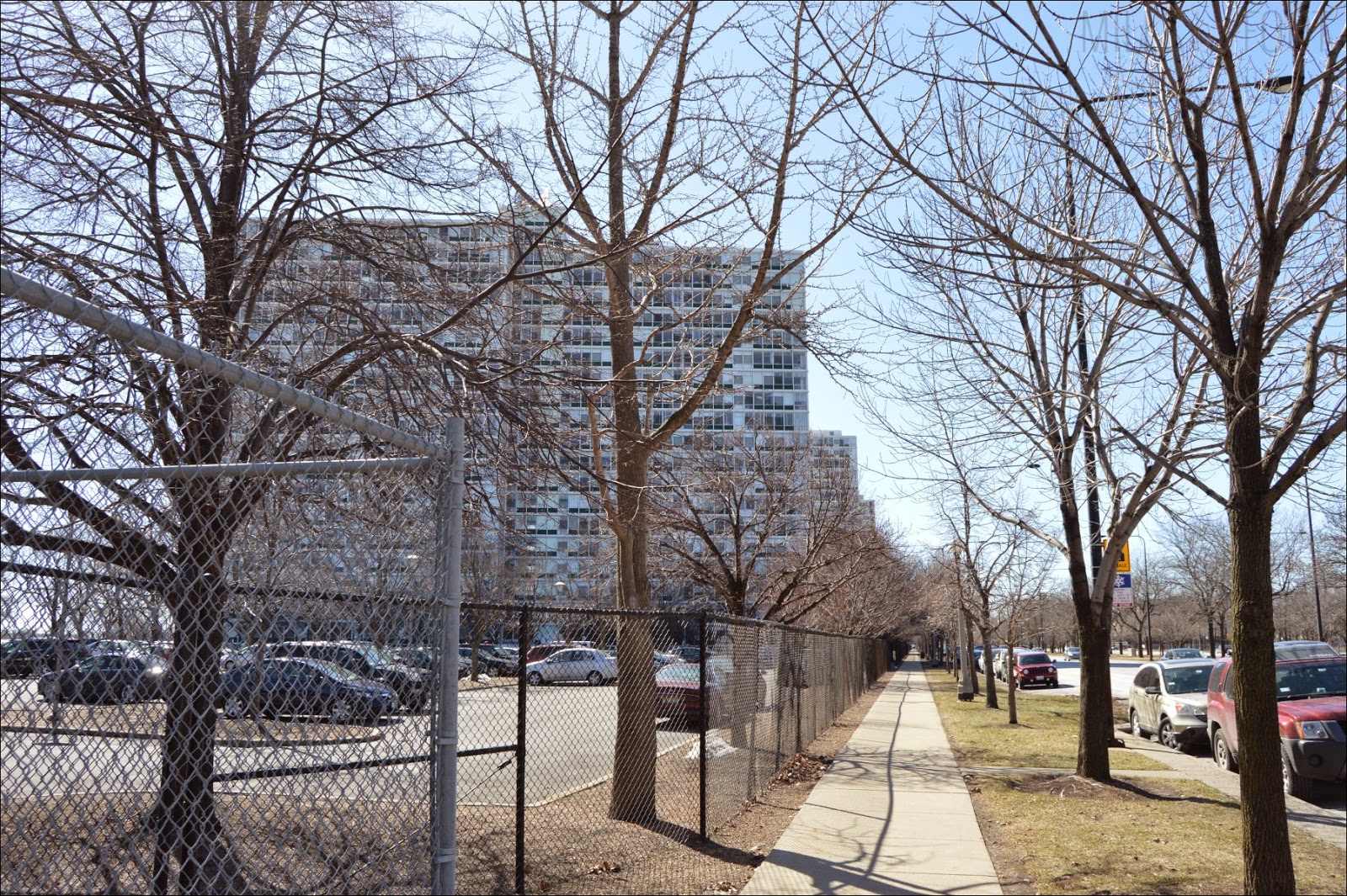
A large complex of apartment buildings stretched out to the south.  I always think it’s fascinating that every large building is its own little town; hundreds of these buildings probably dot the landscape of Chicago, each its own city.  Someone on the 5th floor of the second building back on the left could have just had a baby.  Maybe someone on the 14th floor of the first building on the right just got a job promotion that will help stabilize the family’s finances.  Everyone has a story, and we’re ignorant to so many of them.


Just down the road, I found my crossing onto Martin Luther King Drive; I crossed 31st Street heading north and began my next long stretch.  This wide thoroughfare featured large apartment buildings on the east side of the street and a divided, eight-lane highway on the west side.  Despite its size, it wasn’t terribly busy this morning.


Dunbar High School is a prominent high school in the city; it shares its name with a big high school in Lexington, too, in the western part of the city there.  A bit of research confirmed that they were, indeed, named after the same person, and this Dunbar High School has some pretty famous alumni, including Jennifer Hudson and Mr. T. 


Alternative styles for bus benches are one thing, but I actually have no idea what this is supposed to be, acknowledging that it may not supposed to be anything.  It looks like an abstract spatula being held to the bench by three over-exaggerated nails.  As I snapped the shot, a lady waiting in the bus stop beside the bench gave me a funny look.  Well, the bench gave me a funny look, so that’s understandable.

The apartment blocks stretched along the entire length of the drive so far; all of them looked roughly the same, so I feel like it’d take a lot of experience in the area would be required to not drive or walk up to the wrong one time and time again.


This nifty bronze statue sat in a small, circular plaza in the center of Martin Luther King Drive.  I was concerned on how to actually get over and see who it was, so I kept my pace. 


When plotting out the trip, I incidentally passed through a place called “McCormick Place.”  Even looking through a Street View, I couldn’t quite figure out what McCormick Place was; a mall, perhaps?  A sports arena?  I’d be making my next turn once I passed McCormick Place, and the directions were making me nervous, so I pulled out my phone at the stoplight.  It still had 60% battery, so I brought up my map application to check my location and the crossroad I’d need to cut over to Soldier Field, which was another “take the stairs” kind of direction.  The light changed and I galloped across the crosswalk and under I-55.


Apparently, this little part of Chicago is called Bronzeville, so that anonymous bronze statue makes a lot more sense!


If I had to take my guess, I’d say that McCormick Place is a convention center; the huge drop-off areas, mammoth floor plan, and broad lanes to ferry thousands of cars a minute.  Also, it had multiple buildings on both side of the street.  I ducked into the portico on the right.


While normally I’m sure this would be teeming with carpoolers and large cargo trucks, the convention center, or at least this part of it, was deserted.  While I was out on the sidewalk, it felt like I was in a large city.  Here, though, the sound was the only indication that something was going on outside. 


Chicago’s ABC station is one of their more famous affiliates; they’re responsible for the Oprah Winfrey Show.  The fact they’ve got a news van here tells me there might actually be something going on today.


Yeah, there’s definitely something going on.  The crossing guards saw me standing at the crosswalk, but they assumed I was interested in crossing that way; that’s fair, as I was taking pictures of the place and really, why else would I be there?  He waved me across, along with a couple other pedestrians who’d joined me.  I thought about it for a second and said, “why not?”  I crossed with the rest of the mob and we made a beeline for the door on the other side.


I came into a tall convention hall, several floors tall and wide open.  I followed everyone else to the second, then the third floor.  Many wore green shirts and running shorts, and there were booths set up around the convention space signing people up for raffles and charity items.  One women had a bag with “Shamrock Shuffle” on it; the Shamrock Shuffle is a marathon event that Chicago hosts every year and it was to take place the following day.  As the day before race day, I’m guessing this is where they do their pre-race stuff.  I couldn’t tell whether it was a run for charity (though a name like Shamrock Shuffle would suggest that), but everyone in the building was happy and excited.

While they’ve got a fun day planned tomorrow, I won’t be here tomorrow, so I had to keep moving.  I plodded back down the stairs and back out onto the street.
I continued around the bend, knowing that my cross street was across the road; I galloped across and checked my phone.

Uh oh; 40% battery.

That was just from fifteen minutes of running Google Maps in the background.  I was around halfway done with my walk and my phone was hemorrhaging battery power.  I quickly closed every app, dimmed the brightness all the way down, and I considered turning off the cell signal.  I would have turned it off, but my phone’s off switch is broken, so if I turn it off, I can’t turn it back on without plugging it in for a considerable period of time.   I kicked myself for forgetting to close my map app; rookie mistake.  I’d have to sip on my battery until I got to the airport, I guess, because I wasn’t planning to stop somewhere and let my phone charge.


This crossroad is little more than an alley lined with newer apartment buildings.  To the left, I saw something a bit unique.


When I saw this, I considered what this meant.  I’m imagining a library of guns, with little tables with certain kinds of bullets in each drawer.  I’m sure it’s not so simple, but it is a huge building dedicated just to guns and ordnance; it’s gotta be filled with something.
Shortly ahead, a sign pointed to Soldier Field, one of my walk’s main anchors.  It directed me to a tunnel to my right, where I’d pass under the commuter rail line and pop out near the stadium.


A series of tunnels, it turned out.


Because I’m not doing this on a game day, I just had to imagine the thousands of spectators wandering through these tunnels, looking to catch a home game of the venerated Chicago Bears.  The Bears are one of those teams that aren’t as flashy or consistent as teams like the Patriots or the Packers, but they’re always there, doing their thing, playing their games.  They’re another one of those All-American things I associate with Chicago.


Soldier Field, named as a memorial for the country’s veterans, is the oldest extant professional football stadium that’s still in use.  It was built over a century ago and although I’d been to Chicago many times, I’d never been here.  It looks older than other stadiums, never mind the modern addition over top the field.  The stadium’s outward-facing structures were made of stone, not metal and fiberglass like more modern stadiums, and the sculpting and details are classically styled. 


Along the side, it bears actual stone columns.  It feels more like a gladiatorial stadium then somewhere where hilariously wealthy athletes smack into each other’s padded uniforms every play.  The stadium was huge, and the stone façade definitely contributed to the immense feeling of smallness I felt as I walked along its length.


Soldier Field is one of those classic Chicago locales, and so much of the area gets its identity from this mammoth stadium.  The city really does owe a lot of its personality and social brand to its sports teams; some of the greatest sports stars in history have cut their teeth in this city.  To walk past one of their greatest schools of learning is an honor.


Although I'd never put two and two together, the Field Museum is named after its neighbor.  I suppose I'd always thought the "Field" was for a person.  I don't know, maybe Sally field was a historian in her spare time.  Much in the style of its more famous neighbor, the Field Museum was a grand, classically-styled museum.  Nearby, the Shedd Aquarium, which was on the edge of the lakeshore, attracted plenty of undersea explorers on a Saturday morning.


I needed to make my way downtown, as Vanessa Carlton would say, but I couldn't go left; Lake Shore Drive was impassible at this grade.  In the hopes of finding another tunnel as I'd found before encountering Soldier Field, I crossed the parking lot beside the Field. 


I love museums; my wife, who offered to come with me on this walk, loves them too.  We'll have to come back sometime and hit them up; Chicago has so many good ones to choose from.  It was a pity I couldn't stop and explore here.  Alas, most of today's exploration was outside.

It bears noting that I'd finally become accustomed to the cold.  My face wasn't numb, but it was hardened; the skin of my cheeks was dry and my nose was stable, though probably pink, if I took a guess.  My attire choices turned out to be just enough.

In front of the Field Museum's north entrance, a grassy hill descended to a stone path and one of those hoped-for underpasses.  The lawn was well-tended, even in early spring, and I debated whether it was a no-no to cross down as opposed to walking around to the sidewalk like a normal person.  Nah, there were kids playing at the foot of the hill, so I thought I'd join them.  I leapt down the hill at a run and rounded the corner into what's apparently called Grant Park.


I took a trip underneath it and emerged on the other side; an SUV belonging to the Chicago Parks Department passed me right on the sidewalk as I came out.  Judging by its wide sidewalks and sparser vegetation, Grant Park probably saw much more foot traffic than the Lakefront Trail.


Michigan Avenue: the most famous street in Chicago.  After traversing under the most notable street in Chi-town, I'd be downtown.  The best, most exciting buildings and the hustle and bustle of the city awaited just through there.  I couldn't wait!

Part five will be up next week, so come back and join us.  Until then, keep going!


- Matt